ROUGH AND READY
WORDS AND IMAGES: SARAH FOSTER Ultra runner Sarah Foster likes piña coladas. Fortunately, she also doesn’t mind getting caught in the rain! In 2020, she took a break from the cattle station she co-manages in outback Queensland to run and fast pack the rugged Thorsborne Trail on Hinchinbrook Island. Here, she shares her story for […]
WORDS AND IMAGES: SARAH FOSTER
Ultra runner Sarah Foster likes piña coladas. Fortunately, she also doesn’t mind getting caught in the rain! In 2020, she took a break from the cattle station she co-manages in outback Queensland to run and fast pack the rugged Thorsborne Trail on Hinchinbrook Island. Here, she shares her story for Trail Run Mag.
I grew up on the coast north of Townsville, Queensland, in a little Italian town called Ingham (and no, it is not where the chickens are from!). I spent most weekends with sand and saltwater on my skin and in my hair. One thing I miss the most now that I live on a cattle station in north-west Queensland is the smell of freshly cut sugar cane. There really is nothing like it!
Another thought that plagues me is the fact that I grew up in a town where there were so many natural wonders, but at that time in my life, I didn’t take the opportunity to explore them. It is only since diving headfirst into the world of ultrarunning that I have truly begun searching for adventure. To the extent that when I finish one adventure, I am already looking for the next opportunity to get amongst it!
So, when my friend, Matt, approached me to run the Thorsborne Trail on Hinchinbrook Island, off the coast of Ingham, I jumped at the opportunity. Having spent 21 years living in Ingham, I had never been on this trail before, so I was really excited at the prospect of exploring something near my hometown.
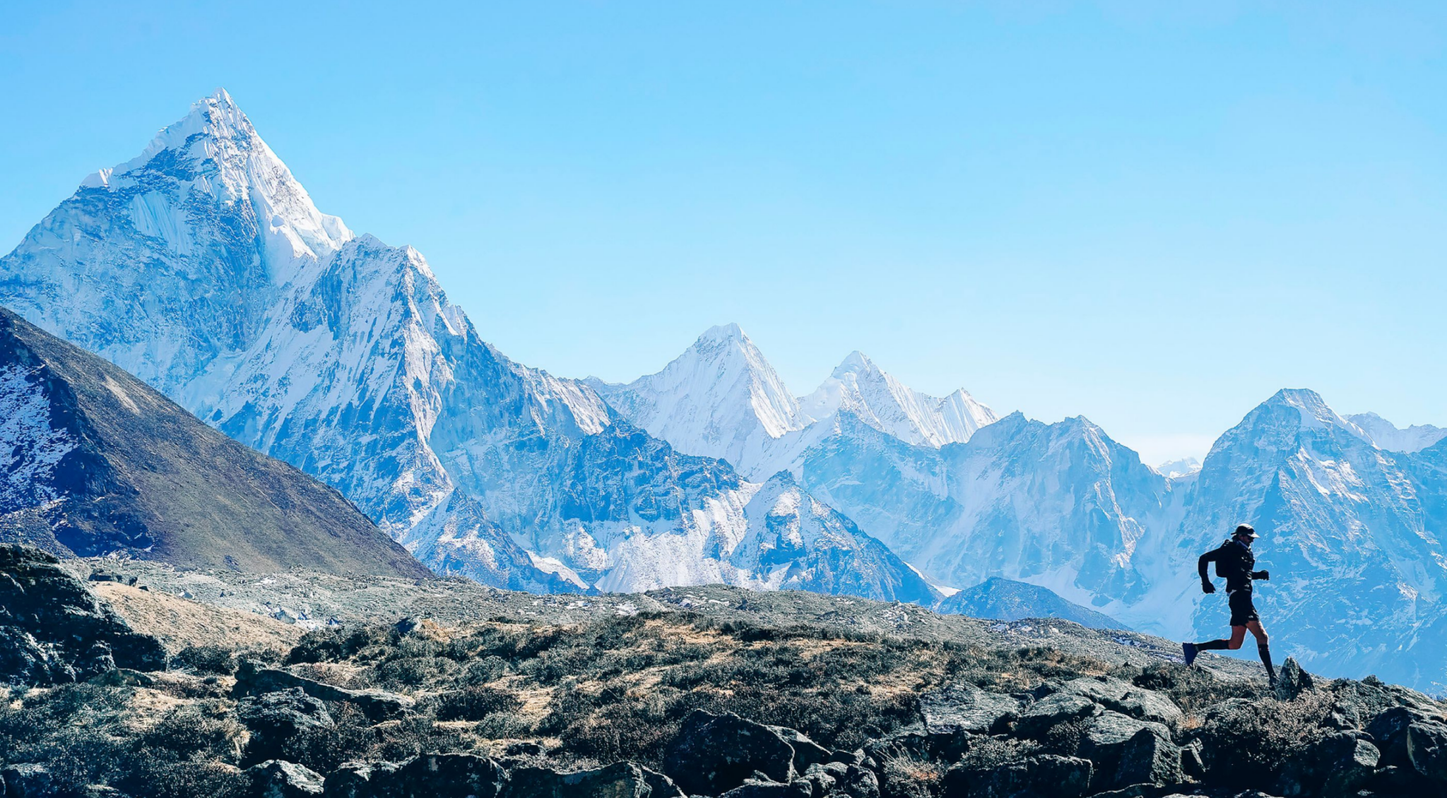
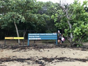
The 32km Thorsborne Trail (one of Australia’s Great Walks) runs from the north to the south of Hinchinbrook Island. We planned the trip hastily the week before we left, securing camping permits for two nights and a ferry trip for the Thursday morning from Dungeness, Lucinda, to George Point. We would return on the Saturday morning. Just a quick trip, running the island from south to north to south again (32km each way, 64km in total) in two days. Epic!
 In my mind, we would have a leisurely run on a beautiful tropical island, after which I would bask in the sun in a bikini beside a waterfall while sipping a piña colada. But when planning a trip like this, you need to give the trail the respect it deserves in its technicality … and actually consider the weather!
So, when we arrived at the wharf on a dreary, wet Thursday morning, my imagination was sorely disappointed. There would be no sun, no leisurely run, no piña coladas, nothing tropical-looking at all, except for my Wild Earth t-shirt! Wet and muddy trails were what we would be getting. Lucky for me, I was pretty much up for anything that involved adventure.
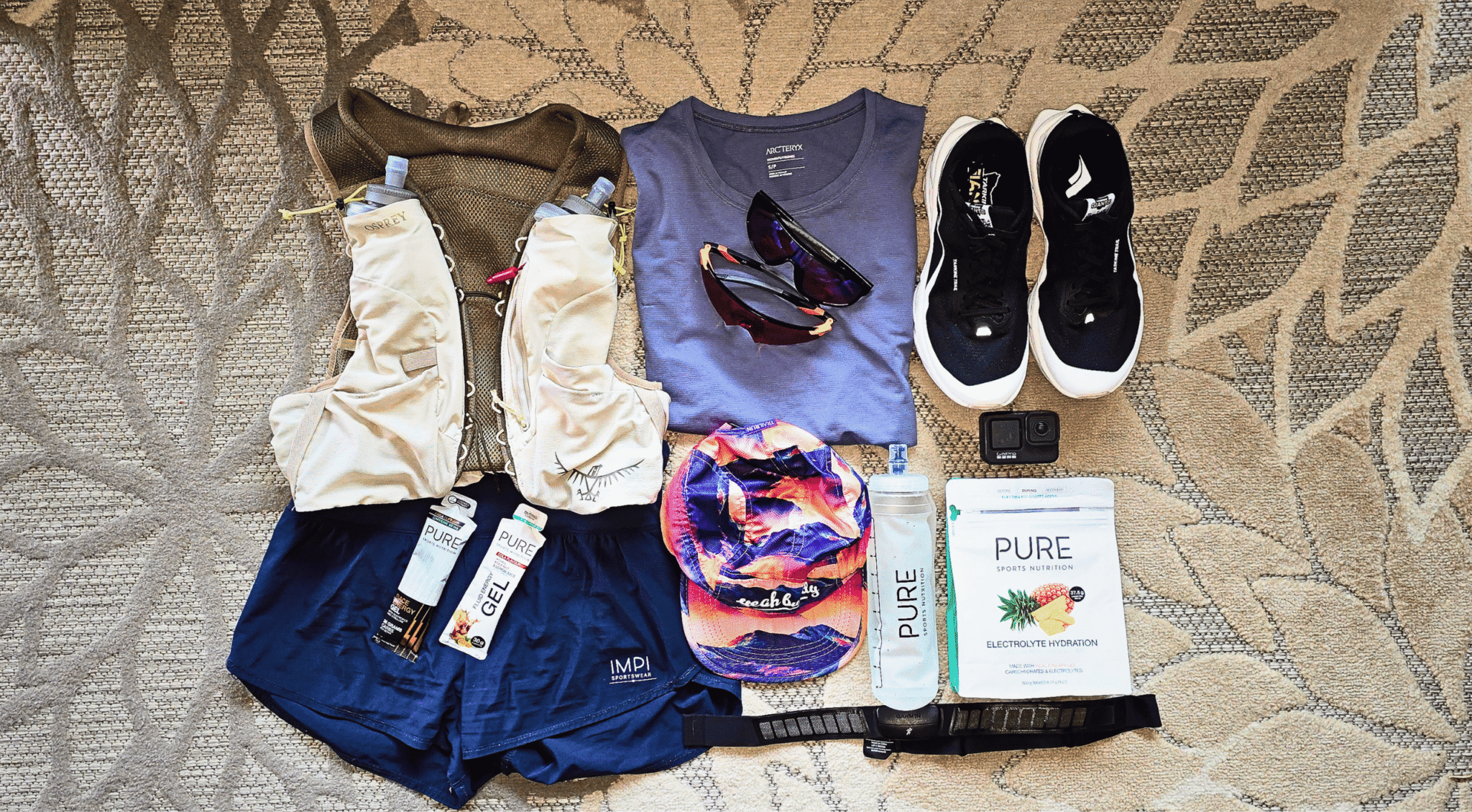
I don’t go anywhere without my Spot Gen3, which has saved me more than once. To keep me warm and dry, I packed my down jacket and waterproof jacket. Other necessary items included one pair of spare socks, a headlamp, dry sack, cup, spork, lighter, stove, snake bandage, bug repellent, wilderness wash and my food for three days. I also chose my favourite Topo Athletic trail shoes to wear, the Runventure 3. I love these shoes, and paired with the Injinji Ultra sock, it is an unbeatable combo.
At approximately 7.10am, we were dropped off on the island at George Point, barefoot and ready for adventure. Wading in from the ocean, we bubbled with excitement. Once on the shore, we put on our socks and shoes in record speed and were on our way.
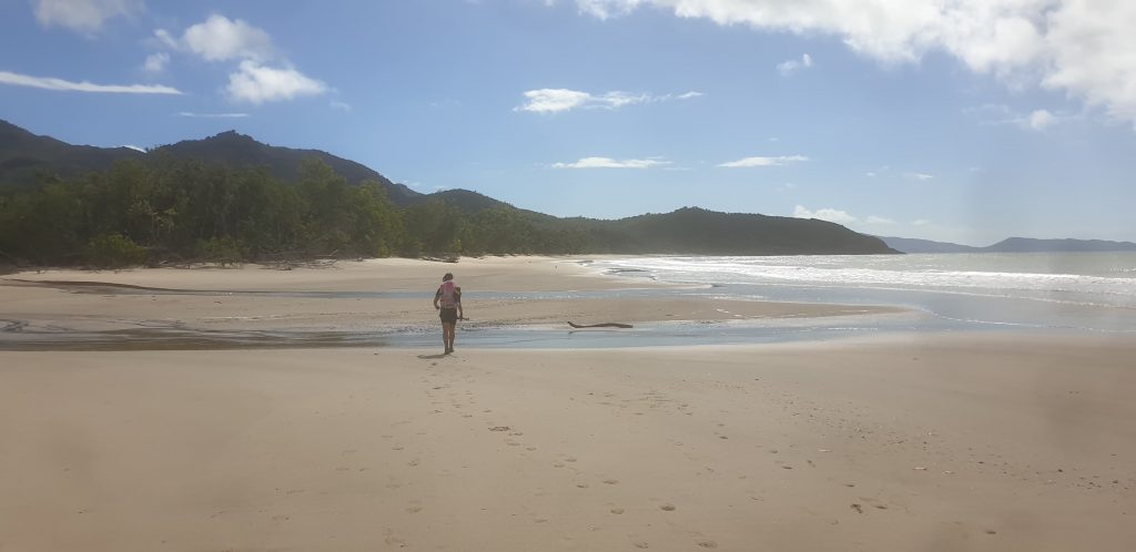
 We had a 4km jaunt along the beach as the sun rose. It really made us appreciate the beauty of the island and ocean. The trail began as we headed into the rainforest and through mangroves. After another 2km, we arrived at Mulligan Falls (which would be our campsite on the second night). We met a group of lovely people who thought we were mad to be running the trail, but they wished us well all the same. Leaving Mulligan Falls, we began a steep climb over some gorgeous bald hills that looked back towards Lucinda, on the mainland, and out towards Sunken Reef Bay. Crossing multiple freshwater creeks and more steep climbs, we descended towards Zoe Falls, where the trail had us cross the waterfall at its full height. The views were amazing, and my trail companion, Matt, jumped in for a swim. I was keen to keep moving forward, as we still had a fair distance to cover and the weather was not in our favour.
Running north from the falls, we emerged onto a gorgeous beach for another kilometre before heading back inland through some open mangrove forests and salty marshes. We were fortunate enough to run through a “moth storm”, with thousands of moths in the air. I captured some video before we moved on.
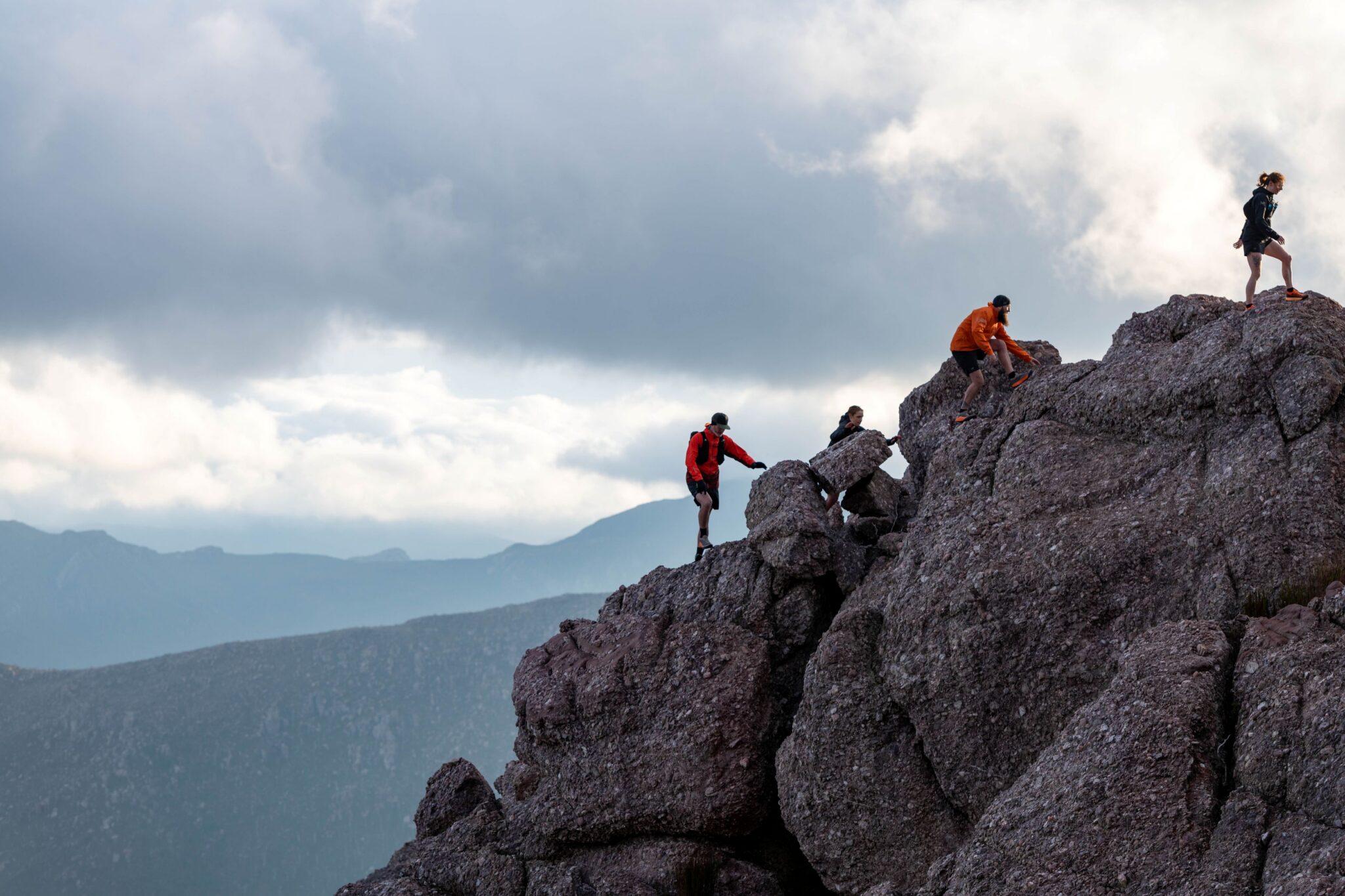
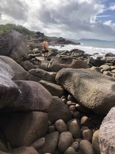 The track from here crossed a few more creeks before beginning another climb up to Banksia Bay, then descended into Little Ramsay Bay. This was where we would make camp for the night. We had covered 25km by this point and it was already 2.30pm, so we quickly set up our tents and put our packs down before heading off for the final 14km return to the north and back to camp. This section was filled with lots and lots of rock hopping. As the rain came down, the rocks became super slippery. This run was fast becoming more than technical; it was borderline dangerous as the incoming tide crashed against the rocks below. Taking our time, we made it safely back to camp just on dark – wet, cold and hungry. We had completed more than half of our run (39km) on day one!
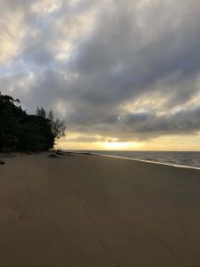
That night was a sleepless one, as the rain pelted our tents and soaked everything. But we would not let this dampen our spirits. We witnessed a gorgeous sunrise as we began our second day on the island. After eating porridge for breakfast and packing our camp, we walked barefoot on the sand to the estuary crossing to avoid soaking our shoes within the first 200 metres. We were again full of excitement as we headed south, passing more hikers who had also had a sleepless night, and crossed our fingers for some better weather.
As we ran, it was interesting to see the trail and island in the opposite direction. I decided that if I had to choose which direction I would rather run, it would be from north to the south. My body had grown accustomed to the weight of my pack, and I was less stressed about having to get the distance done, so I began to relax and enjoy the run. We had only 16km to run that day before making camp at Mulligan Falls, and I was so excited about that waterfall frolic in a bikini!
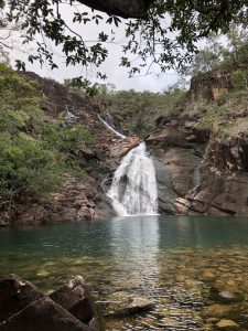 The run back to Zoe Falls took no time at all. When we arrived, we did the climb to the top and sat overlooking the bay, eating Oreos. The view from the top truly put into perspective how lucky we were to have capable bodies and minds to complete what we had set out to do. It is humbling to be at one with nature, living out of a 6kg backpack for a couple of days. The things we can live without when we need to become insignificant.
With terrible weather rolling in once again, we decided to keep moving to make camp before the rain set in. Between Zoe Falls and Mulligan Falls, we ran into a lovely group of people, one of whom had found my jacket, which I had lost the day before. They would also be camping at Mulligan Falls for the night, and we planned to catch up for a chat there. The rest of the trail to Mulligan Falls was filled with gorgeous views looking back towards the mainland, the sugar terminal and jetty. After we descended into the falls, we secured our campsite, set up our tents and hung up our bags. It was finally time for that dip in the falls!
My “dip” lasted about 60 seconds. The water was freezing! Almost as soon as I plunged my entire body underwater, I was back on land, drying off. Maybe I would just stick to sunbaking on a rock while the sun was out, I thought. I laid on that rock until the sun went down, enjoying the peace this trip had brought to my soul.
 As dark set in, I had a quick dinner and crawled into my tent for the night. I lay in bed, listening to the waterfall crash on the rocks and drifted off to sleep. I hadn’t been asleep long when rain started to fall heavily on my tent. It was going to be a long night. We had set an alarm for 4.30am so we could pack up and set off on our final 6km to the ferry, and that alarm couldn’t come quick enough as I lay there, listening to the pelting rain. Finally, the alarm went off, and we were up in the pouring rain, taking down our tents and quickly packing everything messily into our packs. For those who know me, this doesn’t sit well with my OCD! But as I was soaked to the bone and my pack was heavier due to wet gear, I was pretty happy to let it go just this once.
Running through the rainforest in the dark on a trail that was muddy and slippery, in the pouring rain, is a first for me. I don’t see that well in the dark and I’m pretty clumsy, so those last 6km were probably the hardest for me. In saying that, as we emerged from the rainforest onto the beach with the sun rising, it was pretty special and made the struggle worth it. As we ran those final couple of kilometres down the beach to the ferry, Matt and I reflected on the past two days and made a pact that this would not be our last trip to this gorgeous island.
THORSBORNE TRAIL
- Where: East coast of World Heritage-listed Hinchinbrook Island, 8km off the north Queensland coast at Cardwell.
- Distance: 32km one way.
- Terrain: Rough, not graded and often difficult to traverse. Usually takes four days to hike.
- Environment: Lush rainforest, fragile heath, eucalypt woodlands, mangroves, golden beach, rocky headlands, mountain streams and waterfalls.
- Getting there: Short ferry ride or private charter from Lucinda or Cardwell.