Mountain Masochist
Four peaks, two days. Chris Ord takes on a trail challenge in Victoria’s Grampians National Park with an eye to grander plans.
WORDS and IMAGES: Chris Ord
‘It’s not a race, Chris.’
My sensible but rarely listened to self is chastising me as Jess steams on ahead.
‘But it could be.’ My other, more competitive self goads back.
‘It bloody well should be,’ they both resonate.
At least my opposite selves agree on something.
My third self just wishes they’d stop their nattering, the mental noise off-putting as I huff up the granite incline, sweating profusely, swearing more so, berating myself for even thinking that inviting a world champion of any discipline would do anything but rapidly dismantle my ego and instantly call my bluff that I could actually complete this mission.
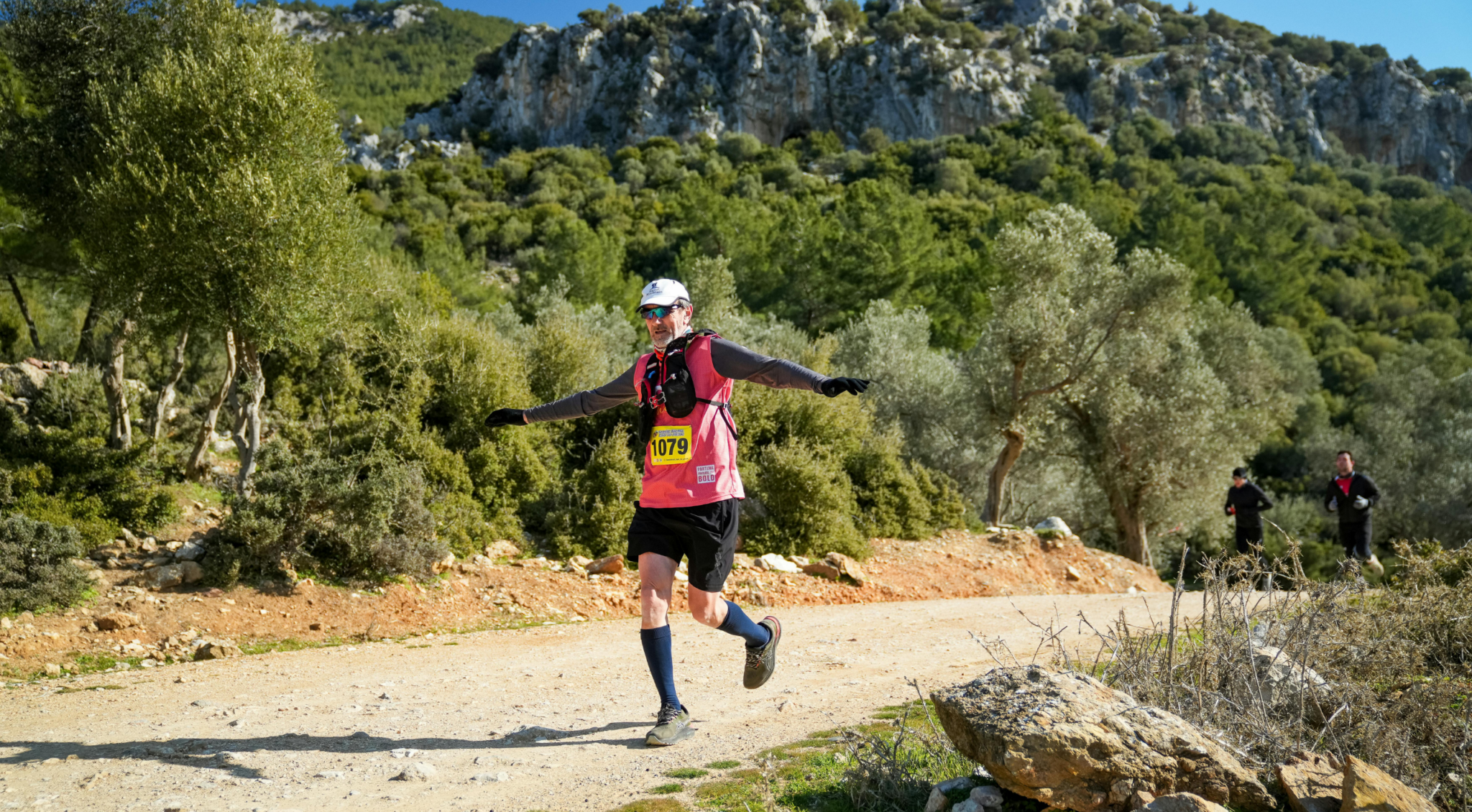
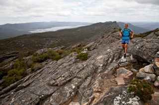
Thing is, I’m a only five hundred metres in on the morning’s trail, part of a two day line-up of that will see me and two-time World 24-Hour Mountain Biking Champion Jess Douglas track from one end of the 168,000-hectare Grampians National Park to the other, conquering its four highest peaks in the process.
‘It could be, it should be…maybe one day it will be a race.’
Natter, natter the noggin drifts to grandiosity again. Yet that’s the aim of this folly: to recce a ‘dream’ trail course in the Grampians for a (for now) non-existent race, one that would test the grittiest of trail runners.
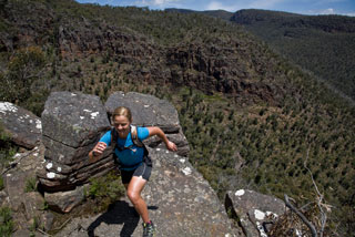
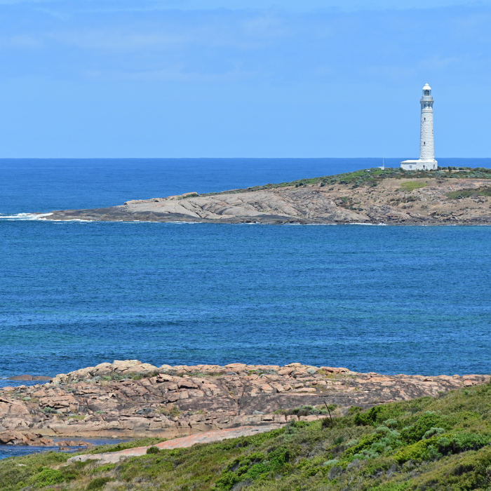
The Grampians National Park (traditional name: Gariwerd) is a north-south stretch that coddles in its contour lined bosom four major ranges: Mount Difficult, Mount William, Serra and Victoria. It’s far from the highest massif in the state, with Mt William only topping 1167 metres, but its Devonian-era sandstone rises up into some of Victoria’s most iconic rock formations; the Pinnacle and the Balconies lookouts being some of the state’s most recognisable stoneware landmarks, second perhaps only to the Twelve Apostles.
Even so, I’d long held the Grampians in contempt as being a faux adventure playground. Thereseemed to me something hollow about a wilderness surrounded on all sides by flat, fenced farmland. It’s as though the only reason it remains laden in Stringybark, Red Gum and ferns, is because colonial settlers just couldn’t be bothered to go the chop – after all, cows don’t climb.
But as my wife says (often and correctly), I was confidently wrong – the Grampians are anything but hollow when it comes to sweet – if brutal – singletrack to run on.
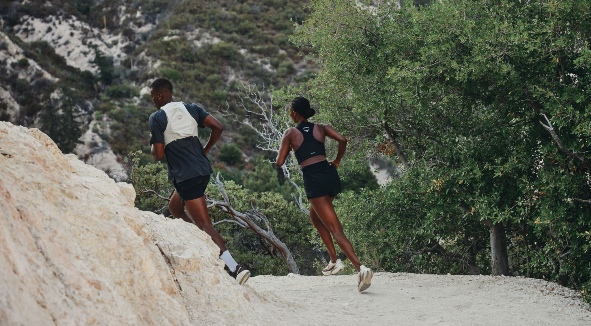
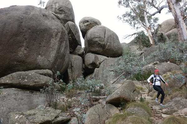
I can see that now as I look up at the orange and blue-grey stone palate looming above us on the run up the flanks of – as it happens – Hollow Mountain, in the park’s far north. The wave-like vision seen through a waterfall of sweat beading off my brow is a popular rock climbing spot for rope monkeys. For trail runners it’s a mishmash of incline running up broad stone slabs, twisting trails through tea tree scented brush and rock hopping up (and back down) gnarly paths marked by the occasional red or yellow arrow.
Our first blood-pumping dash initiates our so-called End-to-End Grampians Adventure – the park’s first, if informal, adventure race, and one that in due course will instigate the flame for establishing one of Australia’s hardest trail events. A race – or races – that will attempt to knock off four of the Park’s pristine peaks.
“Not a race, Chris. Repeat. Not a race.”
Jess is still steaming. Up the rocks, down them. She’s nimble and her mountain biker thighs, taut, almost glowing in strength, work easily over the terrain. These are the same thighs that pumped near continuously over 24 hours, lapping a 20-kilometre course of single trail, to win the World Solo 24-hour Mountain Biking Championship in Canberra and then backed up with a double, winning this year in Italy. Hers are legs conditioned to high intensity endurance and extended periods of pain. They are used to ‘up’. My legs are frog-like: skinny and nimble but quickly leaden with lactic acid.
I am, however, relishing my thigh’s early call to arms, screaming blue murder as it is. Jess, her body working well under capacity, is breathing easy enough to relish the views from atop a wind-chilled Mt Stapylton. The expansive vista eases out to the northeast over farmland and back south down the Grampians’ spine. Having done my map research, I know the name of the range we’re now looking at, and I know it’s no idle threat: in the distance,
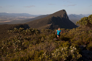 Mount Difficult is to be our second peak for the day.
The run down Stapylton is more of a controlled fall, hopping between rocks, over logs, across a creek, weave, weave, place the foot, next step, watch the branch, DUCK!
Then my ankle rolls.
Ahead, Jess is concentrating on trail breaking of the appropri
ate kind. I muffle a moan that comes from my gut as much as my lungs.
“You good?” Jess yells back.
“Mmmmmphhh. Yup, fine.”
Words then batter against my sense of self-preservation, which is warning me to stop: “I. Don’t. Like. Can’t.”
Discussing her rise in the mountain biking world, and her approach to endurance sports, Jess had last night been forthright in her opinion of quitting.
Thus I muster the ‘can can’.
‘Can. I can keep going. It’ll be right. My ankle will come good.’
Gingerly I keep running, my pace and aggression toward the trail somewhat curtailed.
Bloody-minded stubbornness is another key endurance athlete trait. Without it, you quit.
My mind wanders to my grand idea of an endurance trail run event in these parts and where I’d find competitors with enough bloody-mindedness to have a crack.
Maybe Jess is one of them.
“I just kept going,” she says of her first World Championship win. “One per cent. It was my
one per cent that won that title. It was one per cent that the other girls didn’t have.”
Jess is spot on. While she’s undoubtedly super fit, and her technical skills are brilliant, that critical one per cent is all in the head. It is a mental strength to keep pushing for and adding up all those one per centers. It gets her to the top of the hill. It gets her home. Usually first.
If my ankle can just feel one per cent better in the next kilometre, I can make it back to the hostel today, too. And so I go into my hole of hope, shutting down thoughts, concentrating solely on landing that left ankle, praying away the twinges.
As my ankle slowly numbs with adrenaline, we feather down through the bush and off Stapylton, before hopping onto mountain bikes for a sweep down fast flowing fire roads to the start of the next trail run and a crack at peak number two.
A few paces into the trees and ‘up’ returns with a vengeance. Mt Difficult awaits but not before a crushing 808-metre climb. My conditioning, or lack thereof, smacks me hard as I take long, vertical leaps up rock steps. I can feel every muscle fibre pulling like a tension bridge about to snap as each bound transforms all too powerfully into gale force cramp. Like overstretched sponges, my quadriceps and calves squeeze out nothing but pain.
Now, Jess is a mother of one. Ergo, she mothers. Not in the way that annoys. In the way that she has a spare towel for you (I’d forgotten mine); in the way she has spare chafe cream (I’d forgotten mine); in the way she has spare electrolyte powders (I’d forgotten mine). I’d also forgotten to hydrate over the last stretch. I could be accused of forgetting to train, too, but no amount of gratefully received mothering can help that now.
Instead, she just mothers me up the mountain, peppering our run/walk with positivity and ordering me to stop every five minutes to drink fluids. When my hydration pack runs dry, she’s quick to offer her mouthpiece.
Eventually we top the boulder-strewn peak of Mount Difficult – two down, two to go – and scan down the V-shaped southern spines of the eponymous range. The summit is ours alone and offers an airliner’s view over Lake Wartook, on the far side of which is our penultimate target for the day: Baroka Lookout.
Blown ankles and leg cramps locked deep in the cellar of ‘ignore’, we almost skip down from Mt Difficult, energised by the thought that this is the last trail run of the day; once down we’ll hop the mountain bikes and pedal our way into Halls Gap, a hot meal and sweet sleep in the local YHA ecohostel.
Before such sweet relief, the plan is to rendezvous for a third time with Aaron Davis, our local adventure expert and shuttle runner. Owner of adventure outfit Venture EA, Aaron was born in these parts and, if his zeal is any indicator, born to explore and celebrate the limits of high intensity adventure. Aside from regular adventure tours, he specialises in taking groups – including the likes of the Essendon AFL team – bush and setting them physical challenges that would make a Legionnaires Lieutenant shudder. He’ll employ any discipline, includi
ng trail running, find a suitably grand setting and unfold the most intense bush boot camp you’re ever likely to contemplate.
It was Aaron’s local knowledge that I relied on only 24 hours earlier as we perused maps and developed ad-hoc our two-day trail course. Mirroring Jess’ excitement, Aaron was fizzing at the potential, the possibility of what we were conceiving. In fact, he had already been dreaming of a race of sorts for the Grampians.
“My ideas for the Grampians are inspired by the like of the Three Peaks challenge in the UK,” says Aaron, pointing out on the Grampians map the peaks he would su
pplant in place of Britain’s Scafell, Ben Nevis and Snowdon. “But here, the peaks are all in one place – logistically easier,” he notes.
Another of Aaron’s ideas is to roughly trace the route of Major Thomas Mitchell (1792-1855), the hardened Scottish explorer and Surveyor-General of the fledgling Australian colony, who traversed western Victoria in 1836.
“He named the Grampians,” says Aaron. “His party was headed west from near where Stawell is today towards Mt Arapiles. As Mt William was the highest point, they bee-lined for the summit planning to survey from it, plotting distances from other peaks they
had passed, including the Pyrenees, and hoping to see the ocean.
“So they walked south about 20kms through two rivers and up to Mt William for the night. This was in July – the dead of winter. They survived by lighting moss and moving it on and off rocks they then lay on to keep warm. Two of the party never recovered and were sick for the rest of the journey.”
History records that it was an overcast sky that greeted the party in the morning.
“The cloud never lifted so they didn’t even see the gre
at ‘Gap’ heading south.”
Should Aaron’s own event notions ever be realised, it won’t be for first-timers.
“I often thought of making punters wear the same gear, doing the same cou
rse as much as possible with the same resources.”
And wait for it…
“I’d hold it at the same time of year – winter – as a great ‘early explorer
s’ challenge.”
This is the man I have put my trust in to get us through the Grampians in one piece.
Which may not happen, but it’s not his fault. By our reckoning it is two kilometres down Mt Difficult to our meeting with Aaron.
“Longest two kay I’ve ever run!” I shout to Jess. Steepest two kay, too.
“We need an elevator to get down from here,” says Jess. A steep, knee-shattering descent past some head turning geography, and we exit at Troopers Creek campground. Yes, it was the longest two kay I’ve ever done. Four in fact. We’d taken the wrong trail. We’re on the wrong side of Mount Difficult range. Aaron is waiting for us on the other side, out of mobile phone contact. The wall of rock looming between us also cuts our two way radio contact. We’re stranded. I’m out of water. Again. Light is fading.
Some trail runs (although not all) have navigational challenges. We just failed ours.
We decide to run down the road in the direction Aaron would come if he figures out our blunder. Which he does, eventually.
***********
The following morning’s trail run up Mount William is a short one – only four kilometres – but given this is the highest peak in the Grampians, it squishes in a thigh-melting ascent from 300 metres to the peak at 1167 metres, an average of 200 vertical metres every kilometer, or a 20 per cent grade climb.
With this in mind I start sprouting my excuse theory: “Pro trail runners often say you should never actually run up a steep hill, but stride it,” I say, slowing down to a stride. “Apparently you use more energy in the bounding of trying to run uphill but don’t go any faster than if you stride,” I put my case to Jess.
Either she believes me, or she’s feeling sympathetic because she slows her impressive pace and we meander up the mountain, me serendipitously finding numerous views to stop and admire. One at five-minute intervals as it happens.
Atop Mt William – Mitchell would be shocked to see picnickers and a car park – we suck down some refreshing orange quarters handed over by Aaron, before slipping away down the six-kilometer downhill. For the first and only time during the entire outing, I glimpse Jess’ weakness (she’s seen plenty of mine, so I have no compunction about revealing hers): she stops mothering me and starts mothering her knees. Gently, gently she trots while I stretch my gait, and start feeling the flow and thrill of trail running. You have to look up and ahead, not down; watch where you want to go, and trust that while your eyes look ahead, your brain is processing information gathered a second ago to tell your feet and hands where to place now. There is a flow, a rhythm, but unlike regular running your mind can never switch to autopilot. There’s terrain analysis and strategy going on at pace. Even the skill of urban parkour comes into play as you push off boulders, duck, weave, using your upper body almost as much as your lower. If you get it wrong, the consequences will be felt in a crunching to earth.
Yet geography is dramatic and sets this as a prime if unheralded place for trail running. There are plans afoot to use many of the sections we’ve covered in the last two days, along with newly built link-ups, to create what could be an iconic multi-day trek (I say trail run) north to south taking anywhere from 7–14 days. Of course, an (ultra) trail runner worth their body salt would knock it off in less than 48 hours…wouldn’t they?
Back in the valley, we ride in Aaron’s vehicle to the base of our final challenge; a mountain called Abrupt but better described as just plain rude.
Aaron decides to run this one with us and as the day’s light fades we work our way slowly up the switchback. Jess is still running. I trot, then walk, then hobble, finally reaching the false summit to be greeted by one of the best views of the trip, back north into the national park we’d just run through over two days.
Atop Abrupt, scanning the farmlands to the east, Aaron relates how back in the day here, the farmers were hardened men, “not like today, with your office jockeys who get their weekend dose of exercise on a footy field and that’s about it. These were men who, when their heavy wooden cart broke a wheel, had to lift the whole cart by hand to repair it. They endured day after day in a harsh environment, working their land. Then they went and played football on the weekend.”
Aaron, it seems, longs for a time when these parts were home to more hardened souls. Perhaps they would have been the type of mountain men and women with constitutions tough enough to handle a Grampians Four Peaks Mountain Masochist trail run.
WANNA HURT YOURSELF?
Aaron will get his dream: the Grampians Mountain Masochist is to become a reality with an almighty 100-mile ultra and a multi-day trail race to be conducted simultaneously late in 2013, dates to be confirmed. Prior to that, Aaron will team up with Adventure Types – the mob behind Trail Run Mag – to run a multi day (non competitive) trail tour based on the primary course in March 2013. Anyone looking for a grand adventure (and perhaps write themselves into folklore behind the Mountain Maso) should get in touch for further details or to register interest in taking one of the limited places available on the tour: chris@trailrunmag.com.
Maps: Northern Grampians (1:50,000) and Southern Grampians (1:50,000), both part of the Outdoor Recreation Guide series published by Geocentric Datum of Australia.
Web: more information on the Grampians National Park at www.parkweb.vic.gov.au / www.visitvictoria.com.au/grampians